Overview of parameters and Output modifiers
Parameters
recordingId
The id of the recording, e.g. 510M5HLV
width
The width of the generated image in pixels. 0 = automatically use the width that corresponds to the optimal resolution
Default = 1024
Max = 8192
height
The height of the generated image in pixels. 0 = automatically use the height that corresponds to the optimal resolution.
Default = 768
Max = 8192
srsName
Spatial reference system The definition of the srs is necessary to accomplish the "meridian convergence" correction for the given If not defined, the native reference system (ETRS89) is used. epsg:28992 = RD
yaw
Horizontal direction in degrees in the centre of the generated image. The yaw is expressed and used as a global yaw in the given spatial reference system (srs). 0 = north direction rendered in centre of image (Default).
Default = 0
direction
Horizontal direction in degrees relative to the RecorderDirection (driving direction). This parameter overrides the yaw parameter, when used.
pitch
Vertical direction in degrees in the centre of the generated image. 0= horizon rendered in center of the image (Default).
Default = 0
Range = -90,90
hfov
Horizontal field of view in degrees.
Default = 90
Max = <180
srs
EPSG code of the spatial reference system, without prefix.
x or lon
X coordinate in metres for a projected coordinate system, in degrees for a geographic coordinate system.
y or lat
Y coordinate in metres for a projected coordinate system, in degrees for a geographic coordinate sysrtem.
index
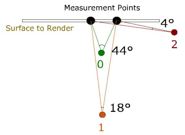
Not used of omitted or set to -1. Otherwise the images are based on views from a multiple of 3 nearby recording locations. 0 = left, 1 =central (same as when omitted), and 2 = right. The views are directed to the requested location.
Default = -1
Range = 0,1,2
z
Z coordinate in metres.
country
2 letter country abbreviation. i.e. NL
address
Address to be queried.
coordinates
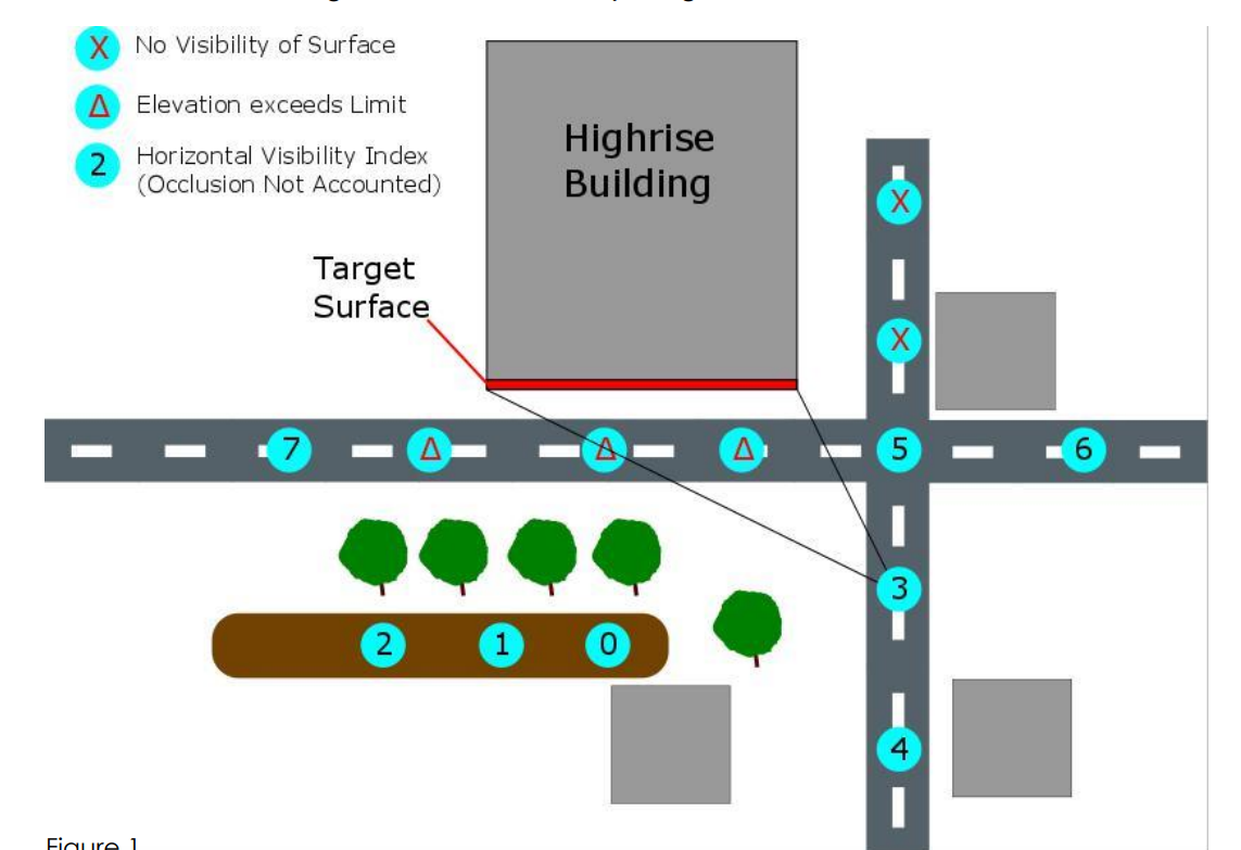
A semicolon seperated list of 4 coordinates in the format of: x;y;z;x;y;z; x;y;z;x;y;z These must be clockwise (as seen from the outside of the building)and should respectively denote the upper left, upper right, lower right and lower left corner, as seen from the observer.
margin
Applies an outward margin both horizontally and vertically to the surface the coordinates describe. (Note: this does affect the returned image’s aspect ratio compared to the actual surface) The margin may be negative, serving as an inward margin.
Default = 0
maxElevation
Sets a maximum elevation angle in degrees that any point of the surface may have from recording locations. A lower maximum elevation enforces a better resolution near the top of tall buildings. This parameter helps ensure a minimum in the quality of a view of high buildings and a more evenly distributed resolution.
Default = 75
Max = <90
maxDistanceToHeightRatio
A floating point value that bounds - relative to the surface height- the horizontal distance between the recording and the surface centre. (This can help minimize occlusion for automated calls e.g. the back sides of houses with backyards; where error responses may be favorable to occluded images).
IncludeHistoricRecordings
Boolean (optional)
Default = false
apiKey
The developer key obtained from CycloMedia to authorize access to this service.
If you do not have an API Key already, you can request one through our Service Desk.
Output modifiers
With the output format and functionalities parameters, the output can be modified. Instead of an image, xml data can be returned, containing the meta data related to the result.
Note: The RenderSurfacemethod returns only a subset of the information below since yaw, pitch and roll are not applicable to its output; please see section Understanding RenderSurface on the left.
This extra functionalities can be accessed with following parameters:
format
Value: xml. The output will be forced to be xml metadata.
filename
A download dialog will be forced with the suggested filename.
Output XML Metadata
width
Units: pixels. Width of the rendered image.
height
Units: pixels. Height of the rendered image
recording-id
Id of the recording used to render the image.
recording-date
Units: ISO date-time. Recording date-time
focal-length
Units: pixels. Focal length.
hfov
Units: degrees. Horizontal field of view.
vfov
Units: degrees. Vertical field of view.
yaw
Units: degrees. Horizontal direction in the centre of the generated image.
The yaw is expressed and used as a global yaw in the requested spatial reference system (recording-location-srs).
0= north direction rendered in centre of image.
pitch
Units: degrees. Vertical direction in degrees in the centre of the generated image.
0 = horizon rendered in centre of the image.
roll
Units: degrees. Always 0.
recording-location-srs-base
EPSG code of the base spatial refence system base of the recording location persisted values.
recording-location-lon
Units: degrees. Longitude.
recording-location-lon-precision
Units: metres. Longitude precision.
recording-location-lat
Units: degrees. Latitude.
recording-location-lat-precision
Units: metres. Latitude precision.
recording-location-height
Units: metres. Ellipsoïdal height, omitted if not defined.
recording-location-height-precision
Units: metres. Ellipsoïdal height precision.
recording-location-groundleveloffset
Units: metres. Groundlevel offset.
recording-yaw-precision
Units: degrees. Yaw precision.
recording-location-srs
EPSG code of the requested spatial reference system.
recording-location-x
Units: metres. X coordinate value in the requested spatial reference system.
recording-location-y
Units: metres. Y coordinate value the requested spatial reference system.
recording-location-z
Units: metres. Z value in the related spatial height system, omitted if height is not defined or if there is no related spatial height system.
url
Corresponding URL that can be used to really render the image.
Examples:
Generate XML data:
https://atlasapi.cyclomedia.com/api/PanoramaRendering/Render/5B0Q4X2T?width=1024&height=786&srsName=epsg:28992&yaw=0&pitch=0&hfov=90&format=xml&apiKey=<put_your_api_key_here>
<?xml version="1.0" ?>
<RenderingMetaData
url="https://atlasapi.cyclomedia.com/api/PanoramaRendering/Render/5B0Q4X2T/"
recording-id="5B0Q4X2T"
recording-date="2011-04-07T12:13:35.29+02:00"
width="1024"
height="786"
focal-length="512.000"
hfov="90.000"
vfov="75.018"
yaw="0.000"
pitch="0.000"
roll="0.000"
recordinglocation-srs-base="EPSG:4258"
recording-location-lon="5.248527411"
recordinglocation-lon-precision="0.012"
recording-location-lat="51.832667432"
recordinglocation-lat-precision="0.010"
recording-location-height="48.788"
recording-locationheight-precision="0.016"
recording-location-groundleveloffset="2.00"
recordinglocation-yaw-precision"0.0077"
recording-location-srs="EPSG:4258"
recordinglocation-x="5.249"
recording-location-y="51.833"
recording-location-z="48.788" />
Download dialog for XML:
https://atlasapi.cyclomedia.com/api/PanoramaRendering/Render/5B0Q4X2T/?width=1024&height=786&srsName=epsg:28992&yaw=0&pitch=0&hfov=90&format=xml&filename=ABC&apiKey=<put_your_api_key_here>
Download dialog for JPG:
https://atlasapi.cyclomedia.com/api/PanoramaRendering/Render/5B0Q4X2T/?width=1024&height=786&srsName=epsg:28992&yaw=0&pitch=0&hfov=90&filename=ABC&apiKey=<put_your_api_key_here>
